

Another week, another mystery! Here is the entry for this week. Read the guidelines below, then comment and be sure to include a link to a corresponding map. Then, this Friday we will reveal this photos location in the comment section of this post!
Here are the guidelines,
- If you can correctly identify the photo with a link to Google Maps showing where it is, or should be*, you win! Leave a comment here on the blog or on our Facebook Page.
- Every Friday we will reveal the photo and congratulate the winner! (The first to post the correct answer & link)
- Each weekly winner will receive a coupon for $50 off their next Aerial Photo purchase, or simple bragging rights! Whichever you prefer. (Make sure to provide adequate contact info.)
(*It is estimated that 40% of photos document places that are no longer standing. So, if you can tell us where the subject of the photo used to be, that will work too.)
Enjoy!
Visitor Comments
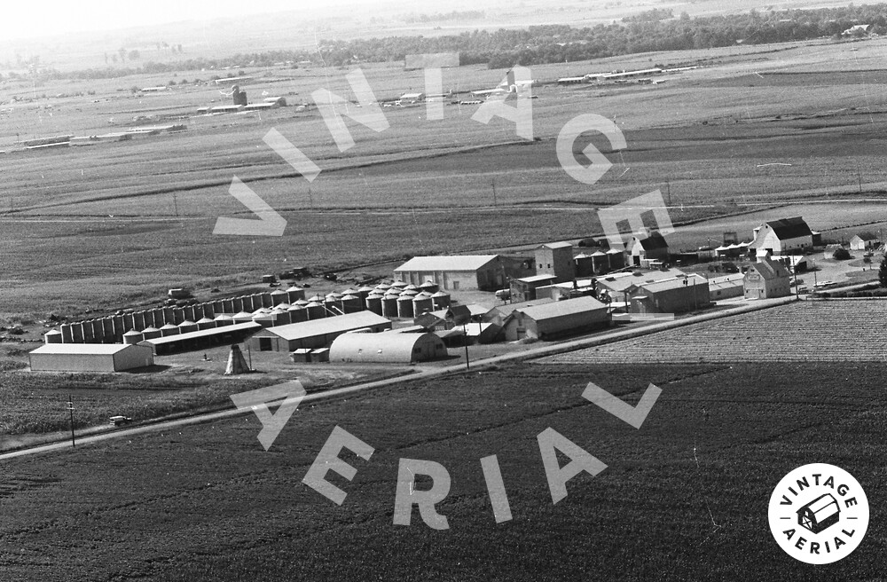
Midwest: grain, flat, orthogonal roads
Hi Randy, You are finally back! You been at a convention or something? Missed having someone with great clues....since Sam in so stingy with them....lol.
So, what do you think....Iowa, corn or soy, part of a co-op and a place that has some reason behind it.....for Sam to pick it out of so many pictures available?
Do you think the Grain Elevators in the distant back have anything to do with this farm?
The grain bins and Quonset hut look like they were part of the Commodity Credit Corporation government grain storage program. I believe the program ran from the late 1940's to the early 1970's. These were usually located near grain elevators/Co-ops, so it would make sense that this may be close to a town. The silos in the back ground could indicate a dairy area. Maybe Wisconsin?
Wow, thanks Frank.....I knew what I was going for, but didn't know those terms and history. I was looking at the age on some of those buildings too.......this site, I would say has been around for a number of years.
But I am still going to look in Iowa, Ohio and there abouts.....even though I don't have much time this week to work on this.
Wish we had a little more to go on, but your description really gave me the words I was looking for.
Looks like this farm has a lot heritage to it... ;)
So, maybe it could be the Heritage Cooperative in West Mansfield, OH, or farm in Heritage in Iowa....hummm.......can't look right now....
We have big wildfire here in Cochise Co., AZ and taking in livestock and ready for folks to evac.....40 homes, and much history lost forever because we didn't have VINTAGE AERIAL..!!!
https://www.facebook.com/pages/Monume...
This is Blacks Heritage Seed Farm, 2 miles South of Ames, IA at 26156 530th Ave
Link to a video is:
http://www.youtube.com/watch?v=QKM0vd...
http://www.youtube.com/watch?v=roQlej...
http://www.youtube.com/watch?v=GakZ5Z...
The address I gave, shows being across the street on mapquest...so must be the headquarters. Can't figure out how to send the link.
OK, here is Google map, and it is across from the "A"
http://maps.google.com/maps?f=q&s...
Great work! Thanks and Congratulations Linda!
Awesome stuff Linda!!!