

We’re kicking off a short series to provide some pro-tips for identifying photos in our collection. To begin, we’ll talk about where these photos came from and the various factors that come into play when some users experience difficulty when searching for a specific photograph.
Way Back When
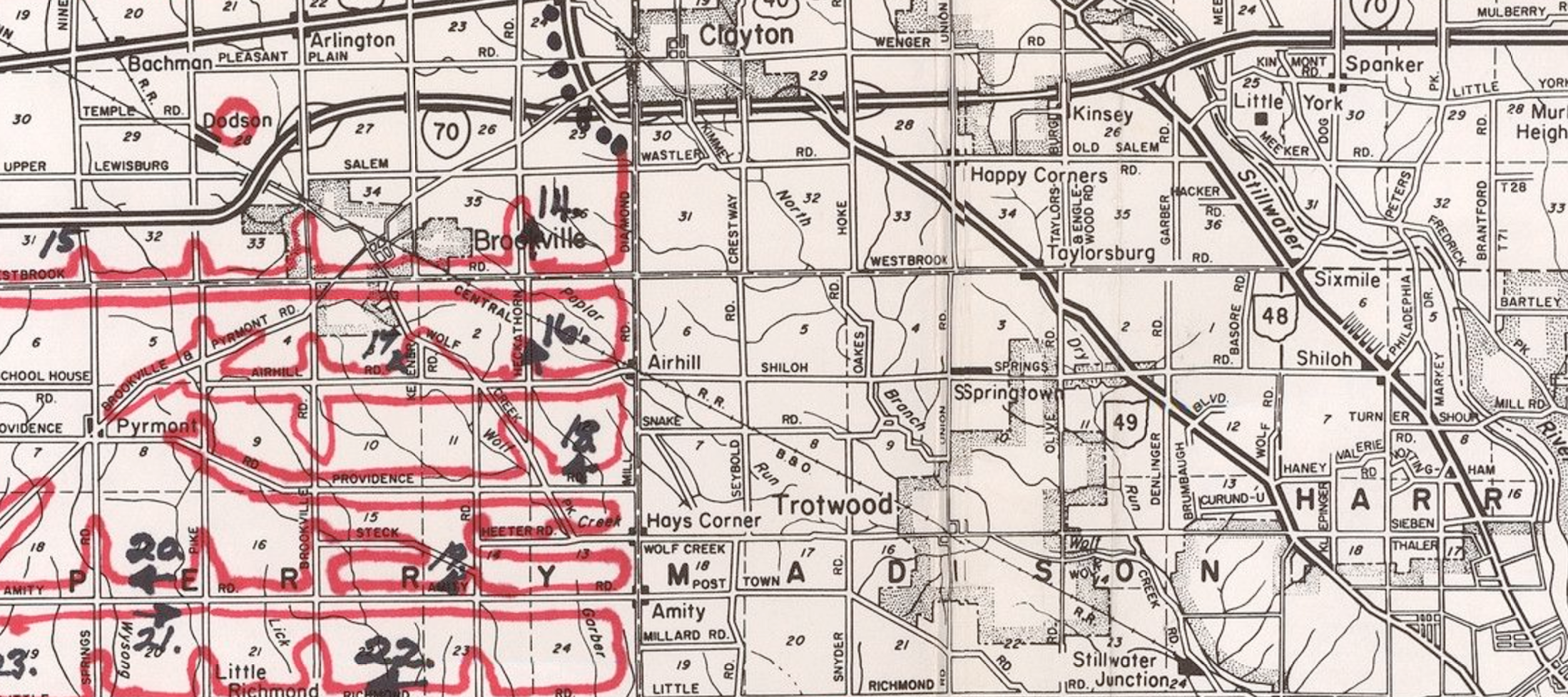
In the early 1950s, cottage aerial photography businesses began to form around the country. Their goal was to photograph rural homes and farms and sell framed enlargements door-to-door. They started by hiring pilots to take photographs of areas they thought to be ripe with prospects.
The pilots created flight path maps and marked their location mid-flight each time they took 35-37 pictures, or consumed a roll of film. As soon as their film was developed, a salesman could begin peddling framed enlargements using the map as a reference to the location of the film.
Today
Decades later, we began digitizing the surviving film and we use these maps to help provide our users with nearby photos when they’re searching for specific places. We’ve converted the red flight paths into sets of coordinates that we overlay onto Google Maps. When a user enters an address, we convert that into coordinates that we can link to the nearest set of flight paths, and thus present users with search results in the form of rolls, or sets of 35-37 nearby images.
Based on the organization of the collection, and our ability to provide search results, we’ve studied some instances in which finding a specific photograph can be challenging. We hope to offer some context to those who ask, ‘Why can’t I find my photo?’
Problems with the collection
Because we can only narrow down a search to rolls of film (approximately 36 images per roll,) it’s not always possible for us to determine if a specific place is represented in our collection. For that reason, users must look through a series of photos until they can visually recognize a specific location.
We also have a significant number of from the 1960s and 1970s that have no approximate location. We’ll be covering this subject in the next post!
Places not photographed
When studying the flight path maps, it’s easy to notice that certain areas weren’t photographed. We came up with a short list that can give some explanation as to why:
- The location was too close to an urban or suburban area. The photographers tried to keep one residence in a frame, and where houses were close together, that was difficult or impossible to achieve, and those areas were typically avoided.
- The location may have been close to an airport, making it difficult to photograph with altitude restrictions or compliance with Air Traffic Control.
- Sometimes large parts of counties just weren’t photographed, and we don’t have a good explanation for this, other than the pilots weren’t instructed to fly and photograph those areas.
How we can help with a difficult search
If you’ve tried finding a photo with us in the past that didn’t amount to anything, or you’re currently in the middle of a difficult search, reach out to us and we’ll do our best to guide you in the right direction.