

Join Our Community
33,411 members are helping us to bring our collection to life.
Create a free Vintage Aerial account now to start commenting on photos, pinning locations, and earning points redeemable for our products!
Sign up now and receive a coupon for 10% off your first order!
Comments
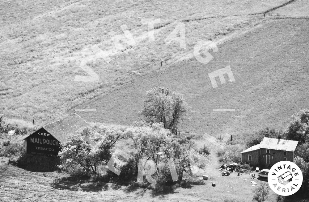
The pin on the map is the approximate loction of where the Mail Pouch barn in the photo above was once located. The Ohio Dept. of Transportation aerial photo archives were used to locate the barn. Photo ODOT # 111-208-234 dated Apr. 10, 1972 clearly shows the barn and other buildings on the site. Photo ODOT # 10233-14-51 dated Oct. 15, 2001 shows that by that date the buildings had all been razed and the site cleared. The Mail Pouch sign would have been clearly visible to traffic travelling east on Deshler Rd (OH-18). The shrubs running along the creek, just west of the barn location in the satllite view did not exist when the barn was existing and did not obstruct the view of the Mail Pouch sign. The barn is ID'd as MPB 35-32-05 on the Mail Pouch Barnstormer's website.