

gas station
We found 29 results for your search in 0.28 seconds:
15-AWI-9
1983
45
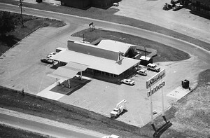
Old Marathon Gas Station off Hwy 96 E./ Murfreesboro Rd
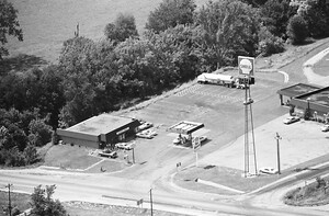
2-TEN-37
1980
133
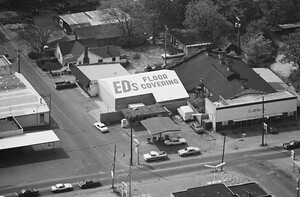
gas station, Carlisle Auto Parts - Columbia Pike at S. Margin St. and 9th Avenue. Most

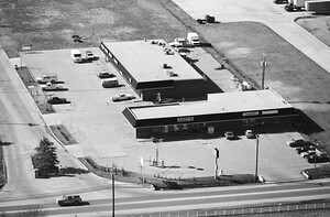
134-TWI-1
1980
90
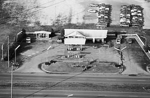
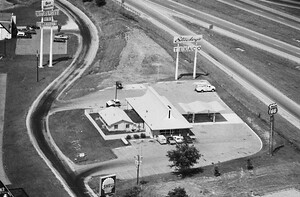
gas station, 1412 Murfreesboro Road, Tennessee State Route 96, Franklin, Tennessee. The view looks south

186-TWI-34
1980
66
Recently the Georgia Boy Gas Station & Food Co. it’s also a CBD Shop now.
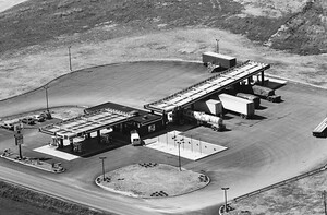
112-TWI-1
1980
101
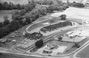
stations, Goose Creek Restaurant, a TEXACO/Stuckey's, and a Best Western Hotel. View is looking north.
The hotel was torn down in 2020
Shell & Phillips 66 gas
112-TWI-3
1980
48
This was at the intersection of Lewisburg Pike and Goosecreek. There is a gas station here now.

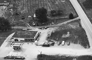
33-TWI-32
1980
30
Puckett's in Leipers Fork. The gas station is now an art gallery.

6-AWI-37
1983
61
Mobil Gas Station on the east side of I-65 along Murfreesboro Rd/Hwy 96 E.

6-AWI-38
1983
59
Hot Stop Market Franklin TN
A new gas station has been built over this.
27-AWI-17
1983
55
The Andys is now a Marathon Gas station. Corner of Beasley Drive and Columbia Pike.
101-WWM-18
1999
21
Franklin, TN 37064 - This is a Gulf Gas Station at the corner of Duplex and Lewisburg Roads.

101-WWM-19
1999
14
2354 Lewisburg Pike, Franklin, TN 37064 - House is next to Gulf Gas Station

83-WWM-32
Pre-1986
13
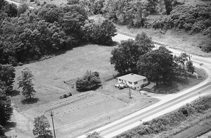
Station Rd. W. just across from the park and behind the gas station near Hwy. 31.

83-WWM-31
Pre-1986
11
Station sale barn. Hwy 31 just north of Thompsons Station Rd. Building no longer exists, although satellite view shows some concrete and footers. Property is to the right of the gas

51-WWM-5
Pre-1986
15
The Old 'Two Way Stop' Gas Station at 7208 Nolensville Rd, Williamson County, TN

101-WWM-1
1986
28
Gas Station
Mr. B's Market & FINA Truck Stop on the northwest side of Exit
29-WWM-32
Pre-1986
22
gas station, intersection of Long Ln. and Peytonsville Rd. Note: Long Ln. is to the left

72-WWM-1
1998
15
Cone gas station. No longer there, redesigned exit ramp from 65S runs through this property.

39-AWI-37
1983
46
Station's Gas Station at Hwy 31/Columbia Pike on the northwest corner with Thompson's Station
111-TWI-32
1980
47
gas station and the Goose Creek Restaurant. View is looking NW.
Shell Oil Company
gas
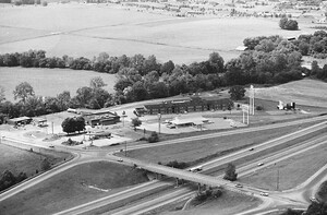
111-TWI-30
1980
64
stations, a Stuckey's Restaurant, and a Best Western Hotel. View is looking NW.
gas
111-TWI-35
1980
72
Gas station is now a Mapco. Goose Creek Inn building is still there.
Signs for Best
111-TWI-37
1980
70
gas station with Stuckey's
Looking at a TEXACO/Stuckey's, 433 Old Peytonsville Road, Franklin
112-TWI-2
1980
100
station, the Goose Creek Restaurant, a Best Western Hotel (pinned), and the BGA archery range. View is looking NW.
Shell gas