Photos
Products
Stories
Blog
About Us
Help
Sign Up
/
Sign In
Home
About Us
Photos
Products
Help
Blog
Stories
ScottSlocum
33 lifetime points
Joined 2020
0
albums
5
Comments
0
Likes
2
Geotags
Recent Activity
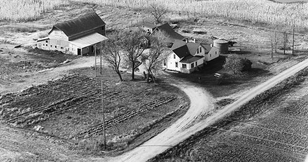
1970
Wright County, MN
Commented & Pinned
House is on the right, granary and a couple of smaller buildings in the center, and dairy barn on the left. Path from barn to pasture goes behind the buildings from left to right.
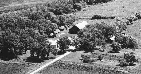
1967
Renville County, MN
Commented
I don't know, but one clue is that this farm seems to have one of one of the area's drainage ditches running along it. Another clue is the shape of the building on the left. I have an old, 1932 photo of the Scott/Howe farmhouse, just north of Stewart, MN, probably a bit east of this photo. The old Scott/Howe farmhouse is shaped like the "building on the left" in this photo.
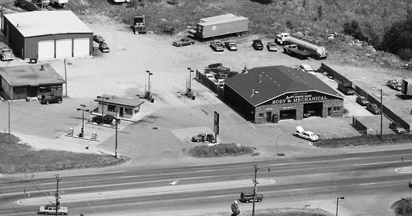
1987
Ramsey County, MN
Commented
It's the old gas station, and the new auto-repair shop, on the Northeast corner of Highway 96 and Centerville Road in the City of White Bear Lake, MN. That old gas station was there as long as I can remember, at least from the early 1960s. Phillips 66? It was later developed into a retail area, including the Walgreens store on the corner, and the McDonald's restaurant next-door, to the East.
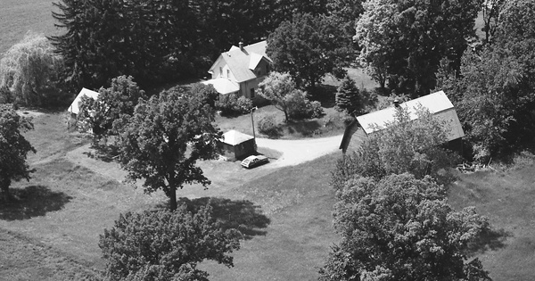
1987
Ramsey County, MN
Commented
I guess that this photo's date of 1987 would identify the new road to the South of the old Lande house and barn as the road to the new City of White Bear Lake water tower (also described in the 2015 White Bear Press article I referred to earlier).