

Join Our Community
33,596 members are helping us to bring our collection to life.
Create a free Vintage Aerial account now to start commenting on photos, pinning locations, and earning points redeemable for our products!
Sign up now and receive a coupon for 10% off your first order!
Comments
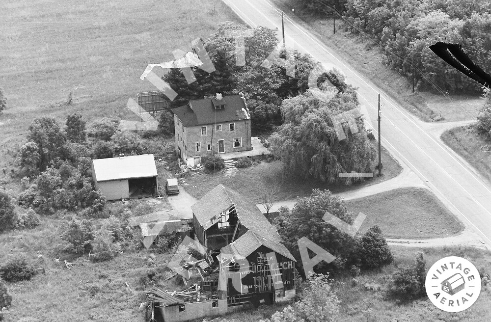
The pin on the map is the location of the Mail Pouch barn in the photo above. The barn, house, garage and driveways are all very clear on Ohio Dept. of Transportation aerial photo # ODOT 146-3401-43, dated Apr. 26, 1970. The only other photo of the site was ODOT # 8006-18-446, dated Mar. 31, 1986. In this photo the house, garage and driveways are clearly visible; however, the barn had fallen and only the foundation is visible by that date. The exact location was determined by setting the scale of the Google satellite image to the scale of the ODOT aerial photo and measuring from the Munn Rd. intersection to the center of the barn. The barn is ID'd as MPB 35-28-10 on the Mail Pouch Barnstormer's website.