

farm
We found 340 results for your search in 1.93 seconds:
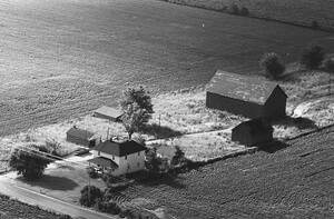
103-KHE-19
1970
31
farm of the McClung family. The house likely dates to the time of Millard F. McClung

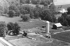
103-KHE-18
1970
33
farm used to be located on the south side of E 550 N just east

88-KHE-6
1970
35
farm is located at
8514 N County Road 150 E
Pittsboro, IN, 46167
It has been
88-KHE-7
1970
29
farm is located at
8514 N County Road 150 E
Pittsboro, IN, 46167
It has been

79-KHE-22
1970
32
farm used to be located on the south side of E 950 N, west of N1075
92-KHE-23
1970
71
Farm of Harrison B. Garner (1828-1901) and Francis Lowder Garner (1831-1905). Home standing

73-KHE-12
1970
58
Fields surrounding the farm have been developed into residential subdivisions; the house is completely surrounded.

73-KHE-23
1970
49
farm of Charles W. Neal (1833-1905) and Emma Bradley Neal (1843-1908). The second
83-KHE-25
1970
41
farm and home of Nicholas Lawler (1810-1880) and Anna Buchanan Lawler (1817-1902). Tax records
73-KHE-5
1970
54
farm was located on the south side of E 200 N, just west of N 1000 E. Ronald

26-KHE-9
1970
30
farm of Daniel Cox (1827-1890) and Elizabeth Little Cox (1833-1923), also known as Fairview

26-KHE-26
1970
25
farm was located on the north side of E 350 S, just west of Martin
26-KHE-31
1970
26
farm used to be located on the east side of S 300 E, just north

8-KHE-20
1970
45
farm used to be located on the south side of E 400 S, just east

9-KHE-2
1970
45
farm of Frank C. Jackson (1872-1951) and (Daisy Fogleman Jackson (1876-1941). The concrete

9-KHE-20
1970
27
farm used to be located at:
2566 S County Road 350 W
Danville, IN, 46122
House

9-KHE-21
1970
24
farm is located at:
2833 S County Road 350 W
Danville, IN, 46122
The small

9-KHE-24
1970
24
farm belonged to the Oscar Benbow (1887-1965) and Daisy Blunk Benbow (1883-1957) family

9-KHE-25
1970
29
Farm used to be located at this modern address:
4310 W County Road 400 S
Danville

9-KHE-27
1970
33
been sided with brick veneer. Barns have been demolished and replaced with modern farming structures.

9-KHE-26
1970
32
been sided with brick veneer. Barns have been demolished and replaced with modern farming structures.

9-KHE-29
1970
30
farm was located on the east side of S 475 W, just south of the bend

9-KHE-30
1970
30
farm was located on the south side of W 300 S, east of S 450 W (see geotag

9-KHE-31
1970
35
farm was located on the south side of W 300 S, east of S 450 W (see geotag