

farm
We found 665 results for your search in 1.14 seconds:

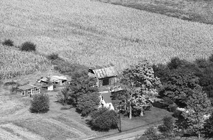
40-KJO-24
1970
84
This farm was on the south side of Worthsville Road just west of 75 W.
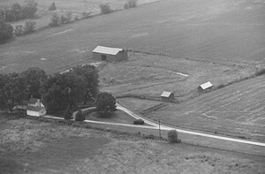
40-KJO-29
1970
83
farm was on the east side of 75 W south of Worthsville Road. The house

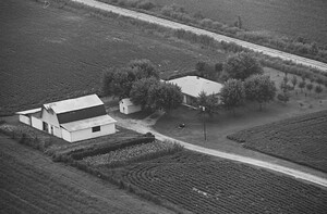
40-KJO-30
1970
77
farm was on the south side of Worthsville Road west of US 31. The house

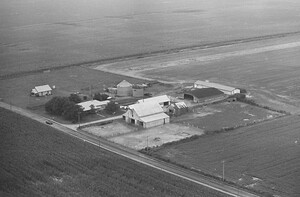
40-KJO-1
1970
100
farm was on the north side of Stop 18 Road west of US 31 where
41-KJO-12
1970
71
farm was on the north side of Tracy Road west of US 31. The house
41-KJO-14
1970
74
farm was on the north side of Tracy Road between 75 W and 125 W. An aerial

41-KJO-31
1970
50
farm was on the north side of Smokey Row Road east of Morgantown Road where

6-JJO-34
1981
28
farm was on the east side of Saddle Club Road north of Whiteland Road. There
6-JJO-35
1981
32
farm was on the east side of Saddle Club Road north of Whiteland Road. There

33-KJO-3
1970
139
farm was on the south side of County Line Road east of Peterman Road where

5-TJO-37
1973
29
farm was on the south side of Smokey Row Road east of Morgantown Road where
3-TJO-27
1973
40
farm was on the west side of Morgantown Road south of Smokey Row Road. The house

18-JJO-26
1981
31
farm was on the east side of Morgantown Road south of Smokey Row Road. The house

18-JJO-16
1981
36
farm was on the east side of Saddle Club Road north of Whiteland Road. The house
21-JJO-13
1981
31
farm is far from the road on the south side of Whiteland Road east of Morgantown
21-JJO-22
1981
32
farm was far from the road on the south side of Whiteland Road just east

21-JJO-30
1981
24
farm was on the South side of Whiteland Road between 225 W and 75 W. The house

17-JJO-33
1981
27
farm is in Photo 17-JJO-33 and Photo 17-JJO-34 of Roll 17 1981.

17-JJO-34
1981
46
farm is in Photo 17-JJO-33 and Photo 17-JJO-34 of Roll 17 1981.
17-JJO-35
1981
32
farm was on the north side of Whiteland Road west of 200 W. The large

17-JJO-36
1981
36
farm was on the east side of 135 north of Whiteland Road. The house and barns

17-JJO-19
1981
23
farm was far from the road on the west side of Honey Creek Road between

17-JJO-17
1981
24
farm was on the west side of Honey Creek Road just south of Stones Crossing

17-JJO-4
1981
32
farm was on the east side of 135 just south of Stones Crossing. This was later