🎄Today is the last day to order Printed Products for Christmas shipping!

Vermont

We have 19,220 aerial photos available in Vermont. Select a county from the list or map to start searching:

Latest Comments

18-QOR-17
1966
144
1
Mill Village Rd, just west of the village. Little Hosmer in background
18-QOR-25
1966
138
1
295 Creek Rd, Craftsbury. Looks just about identical today
18-QOR-30
1966
116
1
In this photo we are looking west at Post rd and N. Craftsbury rd in the background, Wylie Hill rd and Mill...
18-QOR-33
1966
148
1
Tanner rd, off of VT Rte 14, headed from Craftsbury to Albany on the right
18-QOR-34
1966
152
1
~1000 VT rte 14 in Albany. On the right headed north. Currently owned and operated by Chet and Rene Baker as...
24-QOR-14
1966
158
2
on the imagery of road leading west from Perron Hill Road in Glover (3336 E-911 address) the road is "Nick...
29-QCA-32
1966
38
1
4609 Garland Hill Rd, West Barnet? Campers Lane on the Right wood line?
8-RCH-5
1967
211
3
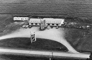
Gas station is Enterprise Rent A Car. Motel is long gone. Road heading to upper right us McIntosh Lane

State Leaderboard

Help us preserve the heritage of rural America and earn rewards by commenting and geotagging photos. Create a free Vintage Aerial account now!

Most Viewed Photos

9-RAD-12
1967
694
9-RAD-13
1967
850
9-RAD-14
1967
623
9-RAD-10
1967
655
5-QCA-14
1966
843
10-QOR-29
1966
1K
14-QOR-6
1966
668
29-QOR-5
1966
652

👋 Welcome! To get started quickly, we can use your device’s approximate location to find photos in our collection near you.

Search Photos Near Me
No Thanks, Continue to Main Site