

Join Our Community
33,546 members are helping us to bring our collection to life.
Create a free Vintage Aerial account now to start commenting on photos, pinning locations, and earning points redeemable for our products!
Sign up now and receive a coupon for 10% off your first order!
Comments
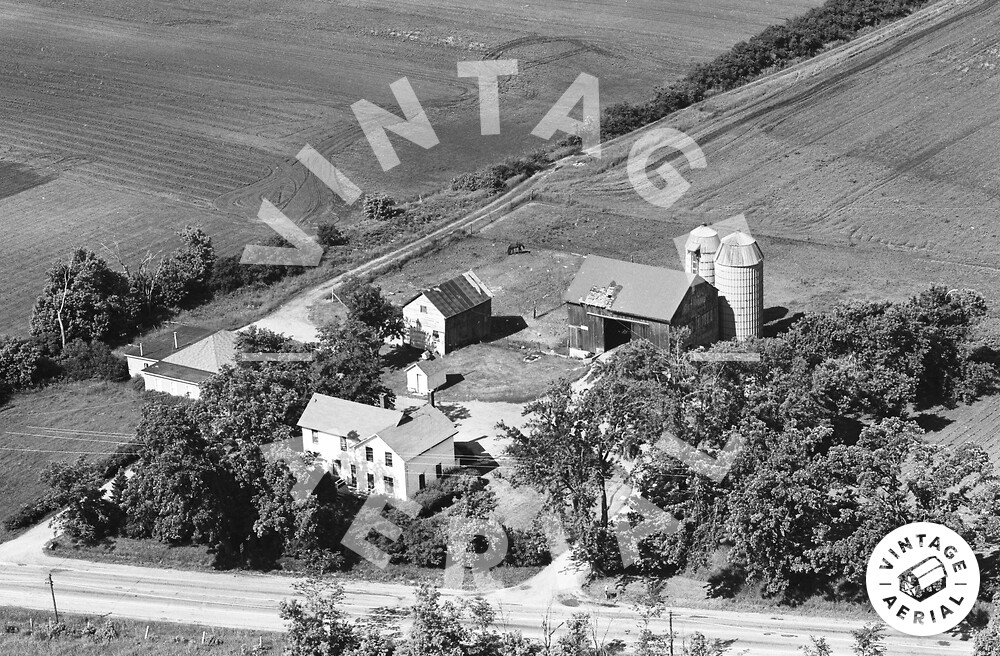
This farm is located at 618 S. Milwaukee Ave., between Woodlands Parkway and Corporate Woods Parkway, just north of Life Time Athletic and the old Forge Club restaurant. The view is looking SW. The little shed in the middle of the photo as well as the small house on the left are still there and visible from the roadway, although it is very overgrown.
I wanted to post one additional piece of information about a location near this farm. About a 1 1/4 miles south on Milwaukee Ave., at the SW intersection of Rt. 22 (Half Day Rd.), there is a remnant from Chicagoland Airport (a.k.a. Half Day Naval Outlying Landing Field), which used to occupy that site and was originally used back in WWII as a satellite site for Glenview Naval Air Station. If one looks closely to the southwest, there is a streetlight partially visible in some bushes. Years ago, this pole was clearly visible and seemed out of place. When I investigated, it turned out there are images online of the old airport and somebody pointed out that the lamp post was part of the airport. The signal beacon tower occupied the spot as well. The concrete foundation from the tower remains in situ around the vicinity of the lamp post. The land has been for sale, so who knows how long it will last. One can see the lamp post using Google Street View and focus in on the SW side of the intersection. These are the cool little things that are subtle reminders of the county's history that I try to keep an eye out for.