

Join Our Community
33,438 members are helping us to bring our collection to life.
Create a free Vintage Aerial account now to start commenting on photos, pinning locations, and earning points redeemable for our products!
Sign up now and receive a coupon for 10% off your first order!
Comments
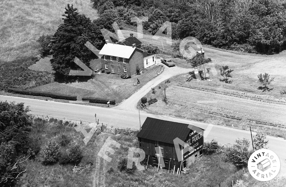
The red pin on the map is centered on where the Mail Pouch barn in the above photo once stood. This site location was verified using Aerial Photos dated 1939, 1958 and 1967 by Penn Pilot. The Mail Pouch barn is ID'd as MPB 38-30-26 on the Mail Pouch Barnstormer's website.
I changed the pin to the proper location. The barn is collapsed, with the rubble still visible on Google Street View. https://earth.google.com/web/@39.9176...
Oliver 1655 you have moved the locator pin to a different Mail Pouich barn. The Mail Pouch barn that you have pinned is MPB 38-30-12 (http://mailpouchbarnstormers.org/wp/?...). The Mail Pouch barn in the above photo (MPB 38-30-26) has been gone for a long time. I am attaching the Mail Pouch Barnstormers entry for this barn and you will note that not only is the barn in view in the 1939, 1958 & 1967 Penn Pilot aerial images the house across the street is also in the views. In addition, the location was provided by Fred Yenerall many years ago. (http://mailpouchbarnstormers.org/wp/?...). I have relocated the pin back to the original location.