Photos
Products
Library Edition
Stories
Blog
About Us
Help
Sign Up
/
Sign In
Home
About Us
Photos
Products
Library Edition
Help
Blog
Stories
alfredkoos
5,611 lifetime points
Joined 2025
0
albums
606
Comments
0
Likes
644
Geotags
Recent Activity
1973
Jackson County, IA
Pinned Location
1973
Jackson County, IA
Pinned Location
1973
Jackson County, IA
Pinned Location
1973
Jackson County, IA
Pinned Location
1973
Jackson County, IA
Pinned Location
1973
Jackson County, IA
Pinned Location
1973
Jackson County, IA
Commented & Pinned
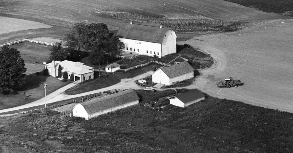
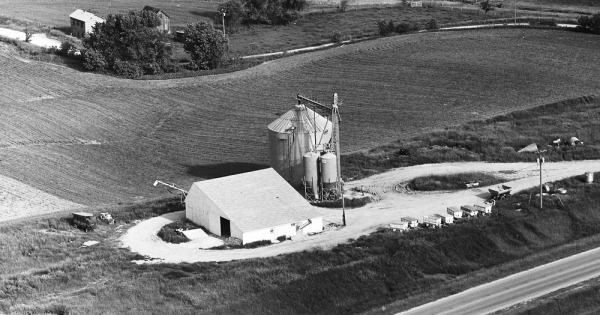
GPS 42.15191523424688, -90.59697698785676 309 W. Madison St., Maquoketa, IA (Camera facing NNE) This farm, now designated 309 W. Madison, lies just west of S. Johnson St. on the outskirts of the town of Andrew.
1973
Jackson County, IA
Commented & Pinned
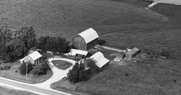
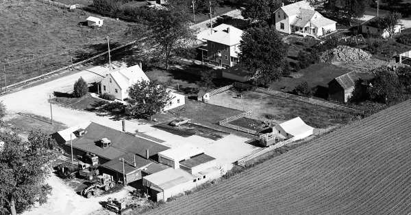
GPS 42.15623038535578, -90.59607464683408 309 N. Johnson St., Andrew, IA (center) (Camera facing SW) We now find ourselves in Andrew, with the intersection of N. Johnson and W. Cass at the left and center of the photo. A tiny bit of Hwy 62 (N. Jefferson) can be seen in the upper left. What is now known as Schwager Rentals (401 N. Johnson) is in the foreground, and 309, 305, and 301 N. Johnson can be seen (left to right). All of these homes are in fine shape today, although many now have larger, more modernized garages.
1973
Jackson County, IA
Commented & Pinned
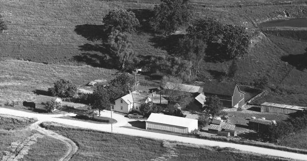
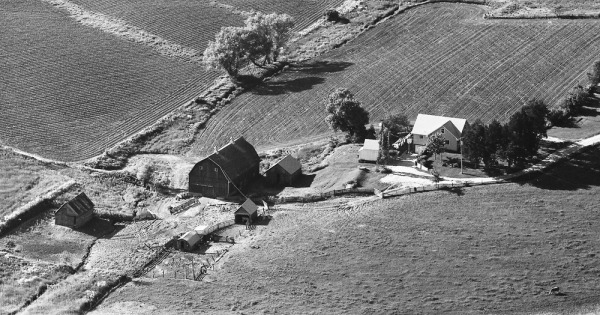
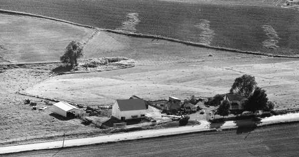
GPS 42.156619677706765, -90.61004381111452 24811 150th St, Maquoketa, IA (Camera facing SW) All of the structures are now color-keyed white, including the 1880 farmhouse in the center. The 'stray' building off to the upper right (SW) was eliminated in later years.
1973
Jackson County, IA
Commented & Pinned
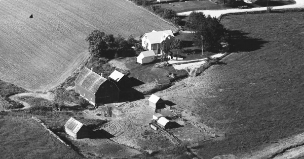
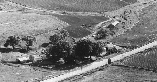
GPS 42.162511662806985, -90.6287656589382 22937 150th St, Maquoketa, IA (Camera facing SW) Nearly all of the buildings have been updated in recent years, and have been 'color keyed' white with red trim.