

Join Our Community
33,483 members are helping us to bring our collection to life.
Create a free Vintage Aerial account now to start commenting on photos, pinning locations, and earning points redeemable for our products!
Sign up now and receive a coupon for 10% off your first order!
Comments
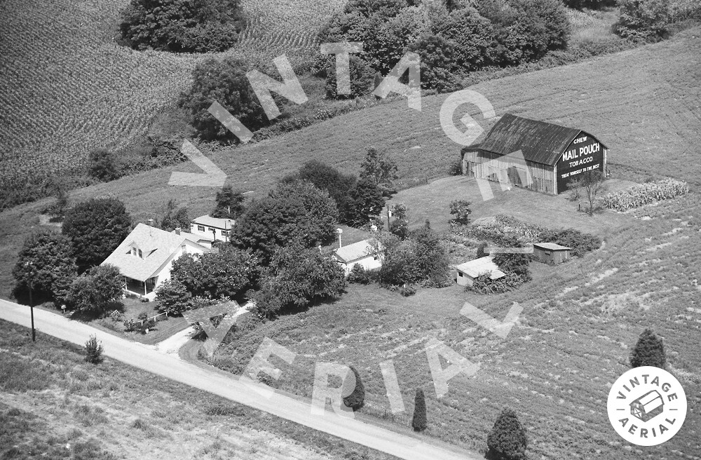
The pin on the map is centered on the house , in the photo above, which remains and can be viewed in 2008 Google street view. The other buildings are all now gone, including the Mail Pouch barn. The site as shown with barn rubble is visible in US Geological Survey Satellite image, dated Mar. 23, 1998. The barn is ID'd as MPB 14-31-06 on the Mail Pouch Barnstormer's website.
https://vintageaerial.com/photos/indi...