Site Improvements

Introducing Historic High Altitude Aerial Photos

Posted on 05/24/2023 by Kevin Marsh in Site Improvements

file

We’re excited to announce the integration of high altitude aerial photos into our collection at Vintage Aerial! These historic vertical photos come from a variety of sources, mostly government organizations, and serve as the perfect historical complement to our collection of oblique, low altitude views. These newly added photos, some from as early as the 1930s, offer a stunning view into how vast areas of America’s landscapes have changed in the century since.

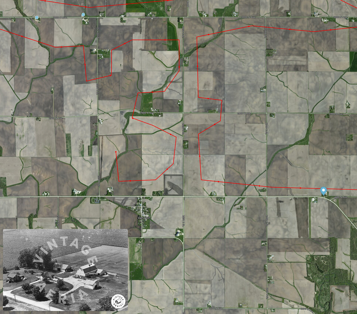
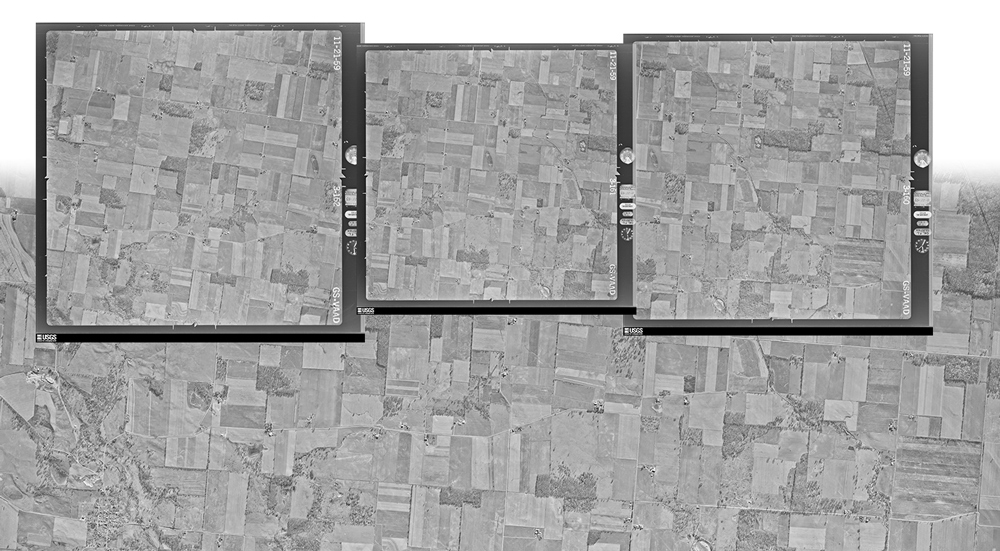
Since learning of the availability of these photographs, the small team at Vintage Aerial has been developing software and processes to gather, organize, precisely geolocate, mosaic, and present these vertical views. Unlike our own collection, which we’ve scanned from the original film archives we’ve acquired, these newly added images have already been scanned in extremely high resolution. And they have been available in various places for some time. But until now, they have been difficult to find, navigate, and make sense of. The work our Vintage Aerial team has done on these images, including geolocation and mosaicking, allows us to layer these images on top of contemporary maps and imagery, and allows our users to browse them in a familiar online map interface.

Today we’re releasing the first batch of our work. This release includes over 322,000 square miles of imagery covering Ohio and Pennsylvania, the two states in which we have the largest number of photos in our own historic collection. The imagery spans the 1940s to 2000s. In the coming months we’ll process and release additional states, years, and imagery sources to augment our own collection of oblique aerial photos.

(sq. mi. of imagery) 1940s 1950s 1960s 1970s 1980s 1990s 2000s 2010s 2020s Grand Total
Ohio 332 26,158 27,449 65,299 666 0 0 22,302 7,526 149,732
Pennsylvania 4,363 25,220 52,556 73,936 8,627 1,053 6,701 13 0 172,469
Total 4,695 51,378 80,005 139,235 9,293 1,053 6,701 22,315 7,526 322,301

We’ve also incorporated National Agriculture Imagery Program (NAIP) imagery into our county and photo-page maps for several years, which makes viewing changes over the years even more striking.

We’re thrilled to present these newly added images to you in this unique way. We believe this additional content will make it easier to find, locate, and enjoy photos in our collection that until now have not been geolocated. And we believe that these images are an interesting resource of its own, a fascinating perspective on the ever-changing American landscape.

New User Profile Page Features

Posted on 03/16/2023 by Kevin Marsh in Site Improvements

We are excited to announce new updates to the user profile page that will enhance the user experience and improve usability. Our team has been working diligently to produce new features that will allow users to more easily navigate their photos and comments.

This new feature provides users the ability to search through their comments directly on their profile page. This feature is especially useful for individuals who have commented on numerous images but have yet to organize them into respective albums. Users can simply navigate to the comment section of the profile page and enter a keyword. All photos that match the keyword will then appear, allowing users to easily find the photo they were searching for or create a new album with a common keyword.

Pinned Images Page

Additionally, our Geotags Page has undergone recent updates, including a newly designed interactive density map that displays users’ geotagging activity. Clicking on the color-coded clusters zooms the map providing more detailed information, and clicking on the small blue dots representing individual pins displays the corresponding photo.

Full-screen Pinned Images Map

Furthermore, users are now able to enable full-screen mode on our Pinned Images Map. Simply click the full-screen icon on the upper left of the map on the photo page. This feature displays a larger, more interactive view of the photo, including the flight path, current photo, and nearby pinned images. Additionally, users can toggle between satellite imagery and street view by utilizing the button in the top-right corner.

Thank you for being a part of the Vintage Aerial community, and we look forward to continuing to serve our users!

Albums

Posted on 03/03/2023 by Kevin Marsh in Site Improvements

I am excited to introduce the newest feature on VintageAerial.com: Albums!

Albums allow you to group together photos from Vintage Aerial’s extensive collection. Whether you are organizing photos by location, family member, topic, or another criteria, Albums make it easy to keep your favorite photos organized and accessible.

They’re also a great way to share photos you find with friends or family. When you create an Album, you can also choose to make it Personal so only you can view your Album.

To add photos to an Album, simply navigate to the photo you want to add and click on the “Add to Album” button. Choose the Album you want to add the photo to, add an optional caption, and you’re done! You can add as many photos as you want to an Album, and you can even create multiple Albums.

Albums are only available to registered users, but registration is quick, easy, and free.

We hope you enjoy this new feature, and invite you to give us your feedback!